Subject: Mid-Atlantic United States
Period: 1912 (circa)
Publication:
Color: Printed Color
Size:
23.1 x 6.6 inches
58.7 x 16.8 cm
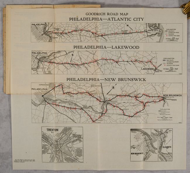
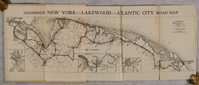
This early Goodrich route book contains two folding maps with directions for New Yok to Atlantic City (and stops in between), and Philadelphia to Atlantic City, Lakewood, and New Brunswick. The maps show the main routes, intersecting roads, and the numerous Goodrich signs along the route in red. 8 pages of text accompany the maps with foreword noting: “This Map Book is presented to the tourist…[It] charts a most carefully chosen road for touring through one section of the United States.” Other sections describe tire repair and care, and the centerfold illustrates how the road signs were installed. In 1910 Goodrich began to install road signs throughout the U.S.; by 1917 Goodyear had installed its easily seen 10-foot signs along 110,000 miles of road. Following Michelin’s lead in Europe, Goodrich also began to issue route books for tourists, highlighting the Goodrich signs and providing specific directions. Goodrich stopped installing signs in 1920 and apparently stopped issuing its route books and maps at about the same time map publishers and oil companies entered the market. Pictorial paper wrappers (5.3 x 9.2") with a Goodrich sign on the front wrapper. No examples of this route book appear in OCLC.
References: Harp (A World History of Rubber) p. 66.
Condition: B+
The folding map at the front has some light foxing mostly around the folds, while the folding map at back is clean and bright. Text is lightly toned and the wrappers have some light stains.