Subject: North America
Period: 1873 (circa)
Publication: Mission of the North American People, Geographical, Social and Political
Color: Hand Color
Size:
22.4 x 23.8 inches
56.9 x 60.5 cm
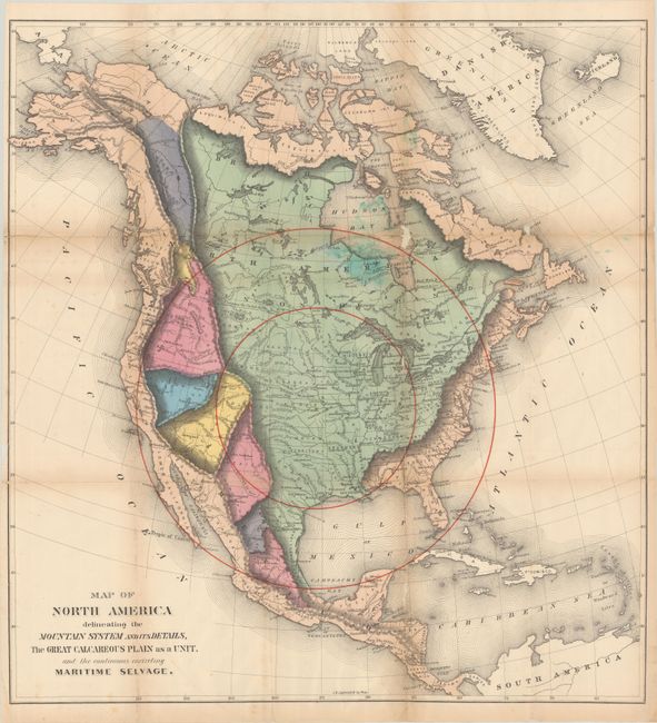
This unusual and colorful map was issued in William Gilpin’s Mission of the North American People, Geographical, Social and Political. The map utilizes bold coloring to show areas of similarity within the Rocky Mountains and Great Plains, as well as concentric circles to represent the future population density with the center of population at Topeka, Kansas.
Gilpin was the first governor of Colorado Territory and a proponent of the concept of Manifest Destiny, the transcontinental railway, and a westward expansion of the United States. He had radical ideas on how and why America should be populated, and to support his theories he created a series of maps including this one. Interestingly, Gilpin's maps were some of the first to show economic potential for the West and to think in terms of regional resources and climates.
References:
Condition: B
Issued folding with small areas of loss along a few folds and numerous fold separations that have been closed on verso with archival materials. There is light toning along the folds and minor foxing.