Subject: History Books
Period: 1804-07 (published)
Publication:
Color: Black & White
Size:
5.3 x 8.1 inches
13.5 x 20.6 cm
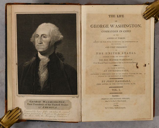
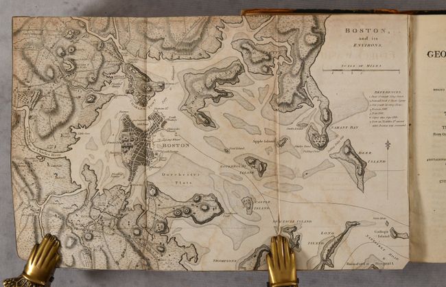
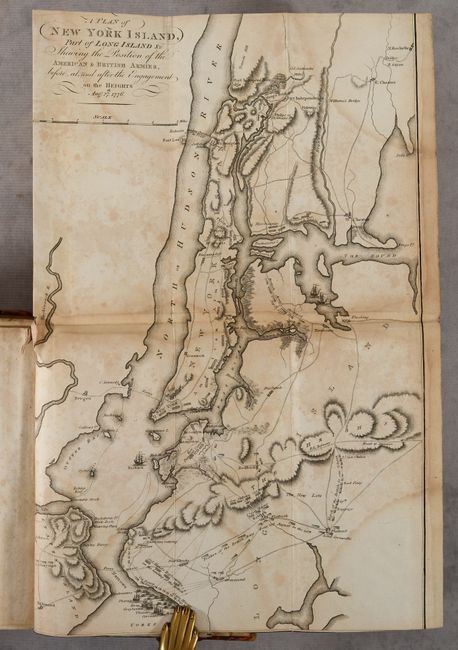
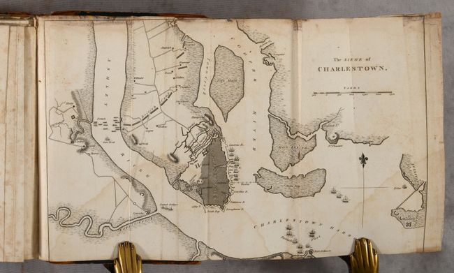
This is the first English edition of Marshall's work, printed in London for Richard Phillips shortly after the Philadelphia first edition. Howes describes this English edition as the "best edition" and Sabin calls it "indispensable." Marshall was a close friend of George Washington and also a principled Federalist. He based this work on material provided to him by the late president's family, and his work is often praised for its accuracy. This example includes 9 (of 12) engraved folding maps. These maps show the positions and movements of General Washington, and several other British and American generals, during the American Revolutionary War. Of particular interest are maps of Boston, Charleston, and New York. The maps included are:
Boston, and Its Environs (12.6 x 8.1"). Condition: Trimmed to the neatlines by the bookbinder with a short fold separation at bottom.
The Siege of Charleston (12.5 x 8.1"). Condition:
A Plan of New York Island, Part of Long Island &c... (9.8 x 16.0"). Condition:
A Map of Part of Rhode Island... (16.5 x 10.0"). Condition:
Plan of the Country from Frogs Point to Cotton River... (8.5 x 16.4"). Condition:
A Map of the Country from Rariton River in East Jersey, to Elk Head in Maryland... (15.2 x 9.8"). Condition:
A Map of Those Parts of Virginia, North Carolina, South Carolina & Georgia... (10.5 x 14"). Condition:
A Plan of the Northern Part of New Jersey... (9.9 x 15.7"). Condition:
A Map of the Country...Through Which General Arnold Marched to Attack Quebec (8.5 x 10"). Condition:
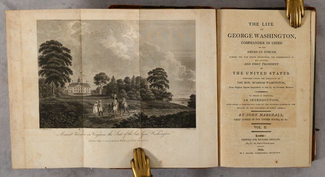
This example is lacking the maps of the Northern Provinces of the United States, the Southern Provinces of the United States, and the Investment and Attack of York in Virginia. The frontispiece to Volume I is Gilbert Stuart's famous portrait of Washington, here engraved by James Fittler, Royal engraver. Also included in the volumes are 3 views: the city of Washington, Mount Vernon, and the elm tree under which Knox made his treaty.
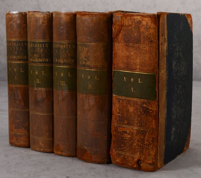
xxxvi, 576 pp.; viii, 631 pp., [1]; viii, 572 pp.; viii, 684 pp.; viii, 843 pp., [1]. Octavo. Hardbound in contemporary half calf over pebbled boards, with spine ruled in gilt, leather spine labels lettered in gilt, and all edges marbled.
References: Howes #M-317; Sabin #44788.
Condition: B
The maps have light to moderate toning, foxing and dampstains, as well as short fold separations and occasional binding tears. Some of the maps have been trimmed within the image by the bookbinder. The text is mostly clean and bright with occasional toning and soiling. The views and portrait are toned. The hinges are starting on several of the volumes, and the covers and spine are beginning to detach on Volume V. The covers and spines of all volumes are well worn and scuffed with some cracking of the leather.