Subject: Atlases
Period: 1811 (circa)
Publication:
Color: Hand Color
Size:
16.3 x 22.4 inches
41.4 x 56.9 cm
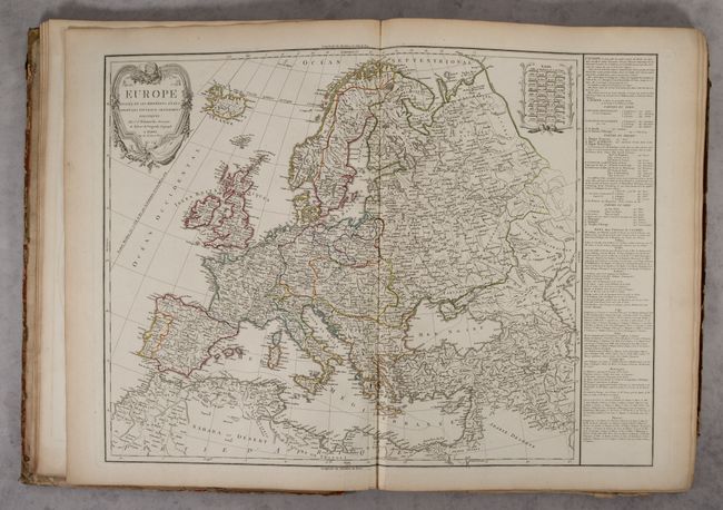
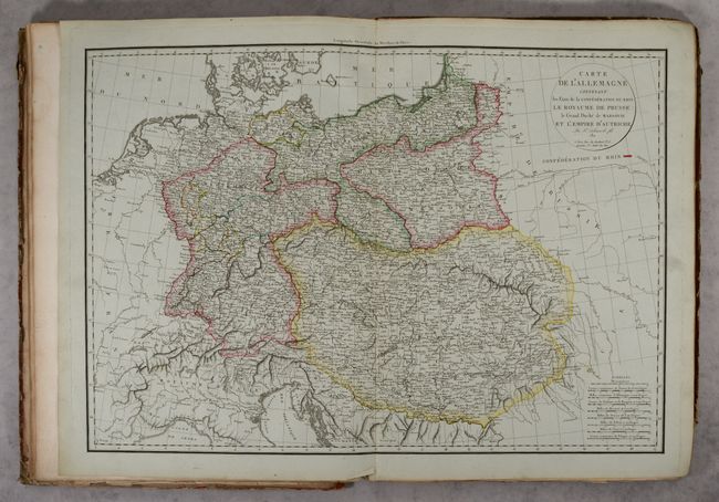
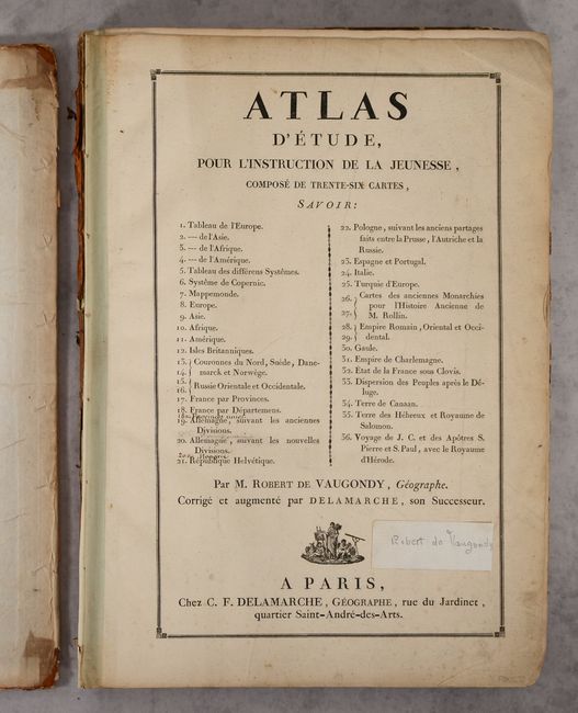
This nearly complete composite atlas contains 33 of 34 double-page maps including maps of the world, Americas, Asia, Africa, Europe, solar system, regional maps of Europe, and maps of the Holy Land. This example is missing only the departmental map of France, which is one of four maps of France that were typically included, but has two additional maps (United Provinces and Hungary) that were added in manuscript ink within the list of maps. Of particular interest in this atlas are:
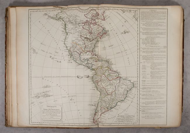
Amerique ou Indes Occidentales includes the discoveries of Captain Cook in Alaska and Hawaii, with several additional islands depicted in the Pacific. The United States is shown confined east of the Mississippi River and the Pacific Northwest is blank except for a few coastal place names. The text panel at right names the thirteen original states with additional notes concerning the creation of the new states of Maine, Vermont, Kentucky, and Tennessee. In South America, the large fictitious lakes of Parime and Xarayes are still prominently depicted (a theory that was not disproved until Humboldt's journey through this region from 1799-1804).
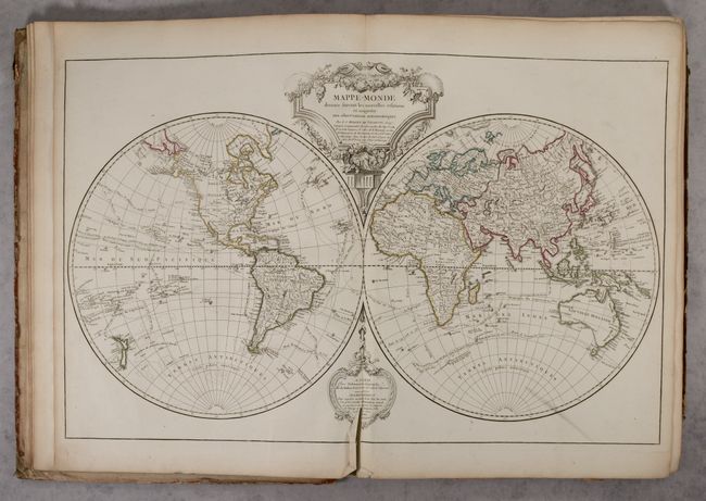
Mappe-Monde Dressee Suivant les Nouvelles Relations et Assujettie aux Obserbvations Astronomiques. The world map has been updated with information, particularly the additional discoveries of Cook, La Perouse, Vancouver, and Mackensie to the year 1802 as noted in the supplementary cartouche. With these discoveries now reflected in the map, we no longer see the notion of a Northwest Passage. However, much of the inland Pacific Northwest is still relatively blank. The large title cartouche is draped with a garland of flowers.
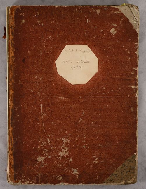
The title page includes the list of maps and is undated. The circa date for this example is based on the maps of Hungary and the German Empire, which are dated 1811. Elephant folio, hardbound in quarter vellum over marbled boards, with a paper label pasted on the front cover with title written in manuscript ink (and dated 1793).
References:
Condition: B+
The maps are generally clean and bright with contemporary outline color and are mostly in "A" condition. Several maps have some extraneous creasing. The map of the world has a centerfold separation at bottom and a few short adjacent tears. The map of Switzerland has a paper label with manuscript writing at bottom center. The general map of France has a long tear that has been poorly repaired, quite a bit of extraneous creasing, and chips in the margins. Eight of the last maps in the atlas have light dampstains that enter the image at top. The title page also has a paper label with manuscript writing. The first signature is nearly detached, and the front cover is completely detached. The covers are heavily worn and scuffed with bumped corners, and the back cover is missing the bottom left corner and has a different marbled paper pasted is parts. The spine is nearly perished. As the maps are mostly in excellent condition, this example would benefit greatly from rebinding.