Catalog Archive
Auction 189, Lot 683

"Chart of New Holland, with the Adjacent Countries and New Discover'd Islands", Stockdale, John

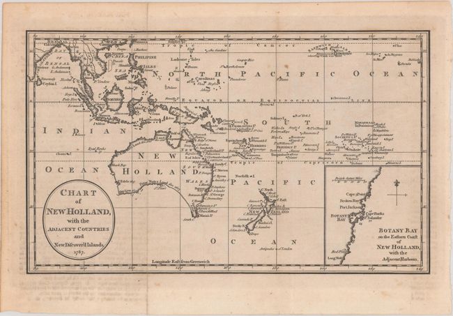
Subject: South Pacific Ocean

Period: 1787 (dated)

Publication:

Color: Black & White

Size:
10.4 x 6.3 inches
26.4 x 16 cm
Download High Resolution Image
(or just click on image to launch the Zoom viewer)

This small map extends from the Bay of Bengal southeast to Australia and New Zealand. It reflects the discoveries of Captain Cook with a completed eastern coastline for Australia and complete borders for New Zealand. The map features an inset of Botany Bay where Captain Cook first landed in 1770. The southern coastline of Australia is still speculative, however, and Tasmania shown as part of the mainland. A small notation near Hawaii indicates that Cook was killed there.

References:

Condition: B+

Issued folding with minor foxing and light offsetting from an opposing page of text.

Estimate: $240 - $300

Sold for: $130

Closed on 9/14/2022

Archived