Subject: Western Africa
Period: 1653 (dated)
Publication: Cartes de Geographie les Plus Nouvelles et les Plus Fideles…
Color: Hand Color
Size:
21.6 x 15.5 inches
54.9 x 39.4 cm
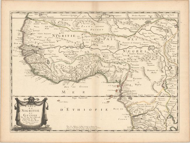
Duval's elegantly engraved map of western Africa only appeared in the first edition of his folio atlas Cartes Geographiques... and is therefore rarely seen on the market today. It extends down the coast from Rio Ouro to present-day Angola, south of the mouth of the Congo. There are plenty of place names, especially along the coasts, and topographical detail. The Niger River is prominently depicted, with its course extending from a lake north of the Desert de Seth to the Atlantic via the Senegal River. Lac de Zaire appears at bottom right as a source of the Nile. There is a decorative title cartouche at bottom right with an African figure holding up a tasseled cloth. Engraved by I. Somer.
References: Pastoureau, DUVAL II [3].
Condition: A
A crisp impression with contemporary outline color on a sheet with a large coat of arms watermark. There is a printer's crease at bottom right and minor toning along the centerfold and edges of the sheet.