Subject: Western Hemisphere - America
Period: 1720 (circa)
Publication: Atlas Historique
Color: Black & White
Size:
17.4 x 13.1 inches
44.2 x 33.3 cm
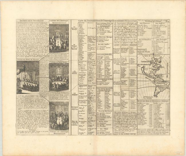
A folio sheet filled with fascinating French text, statistics and four engravings showing the Council of the Indies dividing up Spanish Empire in America. The map itself (3.7 x 5.2") shows an unnamed island of California on the Sanson model. The only political detail is the division of the regions between the colonial powers. Far to the south, a purely speculative Antarctic continent is suggested as Terre Inconnue.
References:
Condition: A
A nice impression on paper with a Strasbourg bend and lily watermark. There is faint offsetting, a vertical printer's crease to the left of the centerfold, and minor foxing that is almost entirely confined to the margins.