Subject: Northwestern Africa
Period: 1609 (circa)
Publication: Gerardi Mercatoris - L'Atlas ou Meditations Cosmographiques
Color: Hand Color
Size:
18.9 x 14 inches
48 x 35.6 cm
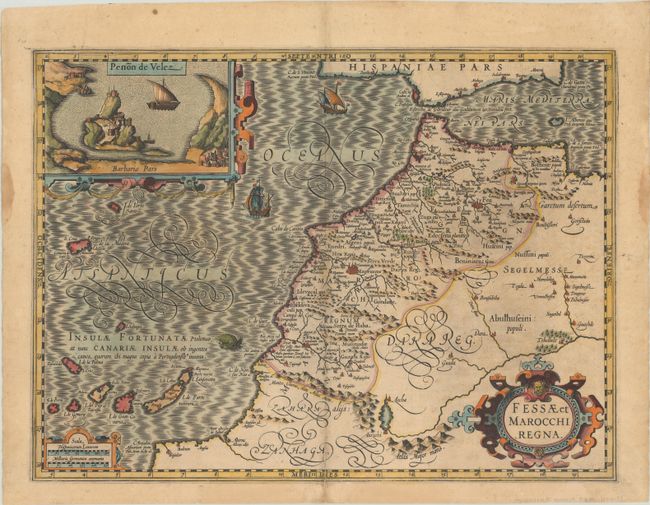
This is one of the most decorative maps of the important kingdoms of Fez and Morocco. A large inset titled Penon de Velez shows the Spanish fort off the Barbary Coast. The map extends into the Atlantic to include the Canary Islands and Madeira. It is richly engraved and embellished with three strapwork cartouches and the sea is filled with ships and a sea monster. This is the first of two maps of the region that were made for Mercator's Atlas. French text on verso.
References: Van der Krogt (Vol. I) #8615:1A.
Condition: B+
A dark impression on a lightly toned sheet with a 2" centerfold separation and a few edge tears at bottom, all but one of which have been closed on verso with archival materials. There are light dampstains in the left and right blank margins.