Subject: Africa
Period: 1779 (dated)
Publication: Moore's New and Compleat Collection of Voyages and Travels
Color: Black & White
Size:
15 x 13.3 inches
38.1 x 33.8 cm
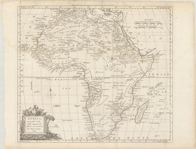
This copper engraved map of Africa reflects typical late 18th-century knowledge of the continent. The Nile is shown originating from tiny twin lakes in the Lunar Mts. located above the equator. The title cartouche features an African queen with exotic animals and a faint engraving of the pyramids in the background. Numerous tribal names are shown throughout. An identical map, credited to Kitchin, was later published in Baldwin's New Complete & Universal System of Geography (ca. 1782). According to Shirley, John Hamilton Moore, the credited author of the geography book from which this map came, may in fact be an invented person.
References: Shirley (BL Atlases) G.MOOR-1a #6.
Condition: B+
A nice impression issued folding with a few short fold separations that have been closed with archival tape on verso and light dampstaining that just crosses the neatline at top.