Subject: Sunda Strait, Indonesia
Period: 1846 (dated)
Publication:
Color: Black & White
Size:
34.5 x 23.3 inches
87.6 x 59.2 cm
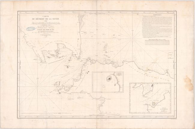
This large and uncommon working sea chart details the Sunda Straight between Sumatra and Java. The sea is teeming with depth soundings, routes, shoals, anchorages, and other navigational information. French text at top right provides more information, with a table below converting meters to fathoms and feet. Inset maps show the anchorages at Merak and Meeuwen. The chart is credited to "Mr. de Tessan, Ingenieur Hydrographe."
References:
Condition: B
There is light soiling, dampstaining that is confined to the margins, and manuscript notations in pencil, including a revised coastline on the eastern side of Sumatra. The centerfold and bottom edge have been reinforced with Japanese tissue, repairing some centerfold separations. There is an ink stamp of a Paris chart seller near the title.