Subject: Japan & Korea
Period: 1778 (dated)
Publication: Atlas Universel...
Color: Hand Color
Size:
21.1 x 18.5 inches
53.6 x 47 cm
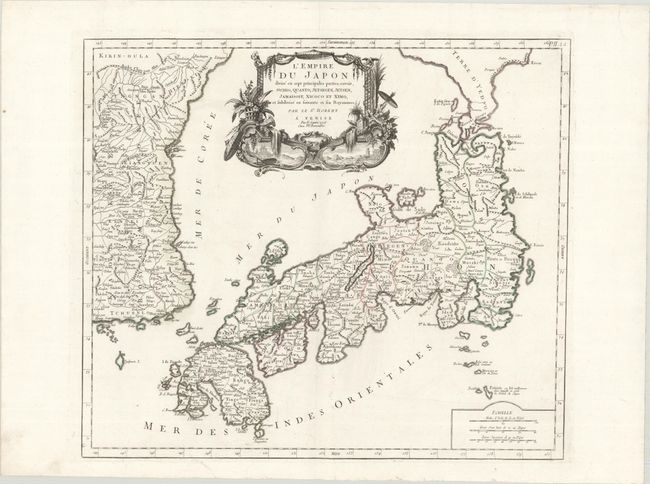
Large, finely engraved map of Japan with a distinctively French style title cartouche containing two small landscapes. The map draws heavily on the previous work of Bellin, but includes a number of improvements to Terre d'Yedso (Hokkaido) similar to the manuscripts of Engelbert Kaempfer. The fictitious island of Matsumae is removed and now Matsaki is shown as a part of Yedso. The provinces are clearly outlined, and there are many place names. The eastern part of the Korean peninsula is also shown with a good amount of detail. The sea between Korea and Japan is named both the Mer de Coree and the Mer du Japon, reflecting a compromise to the long-standing dispute over the name of this sea. This great map was to influence the cartography of Japan into the 19th century. Santini first published a complete re-engraving of Robert de Vaugondy's map circa 1776; this is the second state, with Remondini's imprint added.
References: Walter #86, OAG #118.
Condition: A
A crisp impression with contemporary outline color on a bright sheet, with a short printer's crease in the title cartouche and a few unobtrusive, professionally repaired tears.