Subject: Asia
Period: 1667 (dated)
Publication: Cartes Generales de Toutes les Parties du Monde…
Color: Hand Color
Size:
22.3 x 15.8 inches
56.6 x 40.1 cm
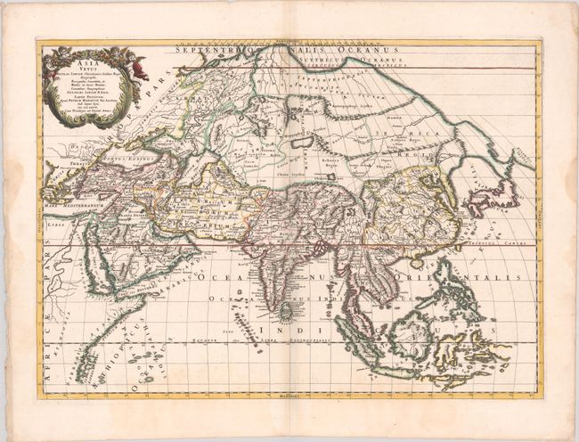
This interesting map is an updated version of the elder Sanson's map of ancient Asia by Guillaume Sanson. The map illustrates the known geography but employs Ptolemaic place names only in the regions prior to the Great Discoveries. In this map the outline of Hokkaido is more accurate, but the island is practically attached to the mainland. A small coastline of North America is labeled Atlantis Insula. Korea is shown as a long thin peninsula based on the Mercator-Hondius model. An important revision on this map is the orientation of the Caspian Sea on a more correct north-south axis.
References: Pastoureau, SANSON V D [202]; Yeo #53.
Condition: B+
Contemporary outline color in the map with later color in the cartouche, on a bright sheet with a large coat of arms watermark. There are light dampstains along the edges of the sheet, entering the image at bottom.