Subject: Persia - Iran
Period: 1720-71 (circa)
Publication:
Color:
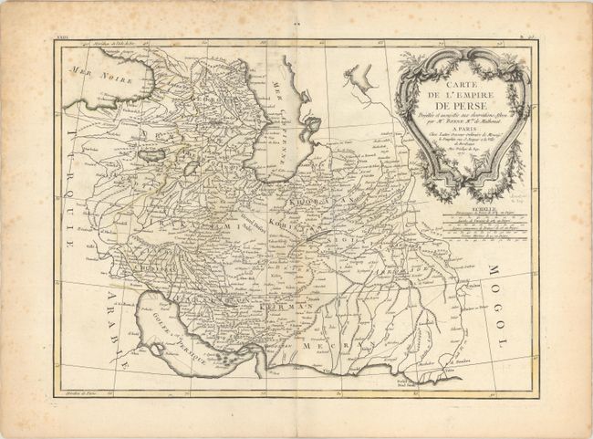
A. Carte de l'Empire de Perse Projettee et Assujettus aux Observations Astron., by Bonne/Lattre, from Atlas Moderne, dated 1771, hand color (16.9 x 12.5"). This finely engraved map covers the region between Baghdad and east into Pakistan to the Indus River. It extends to show the Gulf of Persia and the Strait of Hormuz, and north to show much of the Caspian Sea. The terrain is filled with scores of place names. There is decorative rococo-style cartouche adorning the top right corner. Engraved by J. Arrivet. Condition: A nice impression on watermarked paper with light scattered foxing, much of it confined to the margins. (B+)
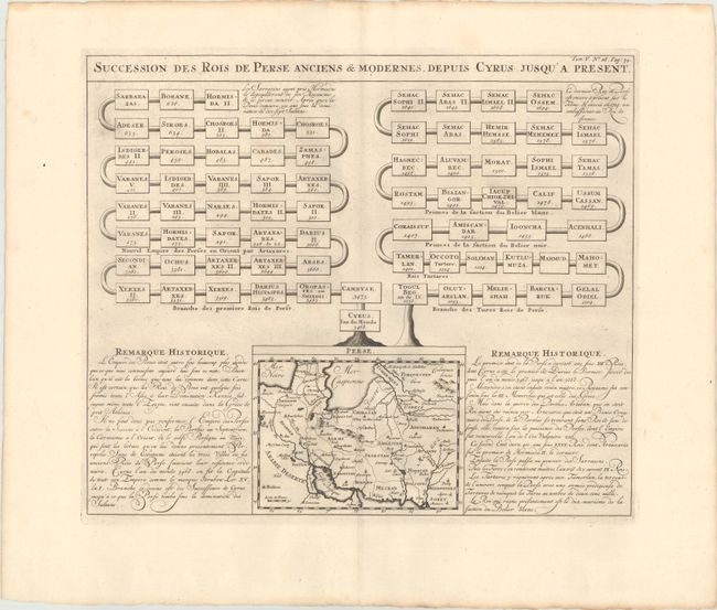
B. Succession des Rois de Perse Anciens & Modernes, Depuis Cyrus Jusqu'a Present, by Henry Abraham Chatelain, from Atlas Historique, circa 1720, black & white (17.1 x 14.4"). This full folio sheet features a small map of Persia (6.6 x 5.3"). The map depicts key cities, boundary lines, and topographical details within Persia. Surrounding the map are two genealogical tables outlining the succession of both "ancient and modern" Persian rulers, as well as historical notes on the region in French. Condition: A sharp impression with a bit of printer's ink residue. (A)
References:
Condition:
See description above.