Subject: Holy Land
Period: 1680 (circa)
Publication:
Color: Hand Color
Size:
21.8 x 18 inches
55.4 x 45.7 cm
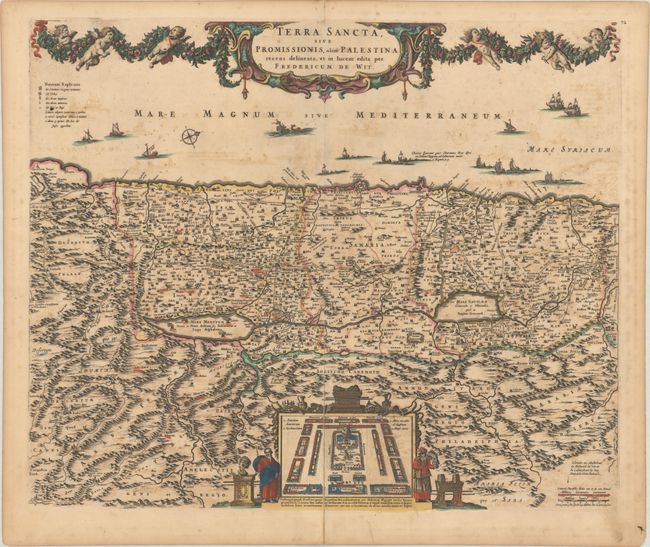
North is oriented to the right on this richly decorative map of the Holy Land. The coast is filled with many different kinds of ships, including one bringing cedar for Solomon's Temple, and another storm-tossed ship with a sea monster that illustrates the Jonah and the whale bible story. The Kishon (Cison) River connects Haifa Bay to the Sea of Galilee. At bottom is an inset of the encampment of the Tribes surrounding the Tabernacle, flanked by Moses and Aaron. The top of the map is decorated with an elegantly engraved cartouche and garland supported by a fleet of putti.
References: Laor #860.
Condition: B
A dark impression with scattered foxing, light offsetting, and a centerfold separation that extends 7" into the image at bottom that has been closed on verso with old paper.