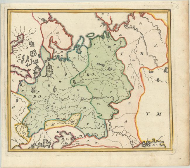
Subject: Russia in Europe
Period: 1719 (circa)
Publication: Atlas Methodicus
Color: Hand Color
Size:
10.8 x 9.2 inches
27.4 x 23.4 cm
This map was intended for geographical instruction, and as such it only shows the outlines of regions and countries, as well as major lakes, rivers and islands. This map shows the region between the Baltic, Barents, Black and Caspian Seas. Each geographical location is identified with a letter that corresponded with an index revealing the answers. This is one of the earliest examples of school maps that used this type of system to teach geography, and according to Rumsey, it was "based on a teaching system formulated by Johann Hubner (1668-1731) and adapted by Homann." The atlas is quite scarce, and examples of the atlas or individual maps are not often found in the market.
References: Rumsey #4385; Shirley (BL Atlases) T.HOM-2a #19.
Condition: A
A sharp impression with full contemporary color, minor offsetting, two small worm holes in the image, and a soft crease at top. There is light foxing and soiling confined to the edges of the sheet.