Subject: Russia
Period: 1812 (dated)
Publication:
Color: Black & White
Size:
46.8 x 22 inches
118.9 x 55.9 cm
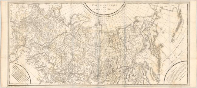
This large-scale map, printed on two joined sheets, covers the entire Russian Empire from the Black Sea to Kamtschatka. It extends to include a portion of mainland Alaska and the Aleutian Islands based upon Russian sources. Several notations are presented along the Arctic Ocean, including one along the northern coastline of Nova Zembla concerning the Dutch expedition led by Willem Barents in 1594-96. The map features very good detail of topography and the river systems in the interior with seven distance scales located in the lower left corner.
References:
Condition: B
Issued folding on watermarked paper with light scattered foxing and offsetting. There are short splits at fold intersections and an edge tear at top that has been closed on verso with tape.