Catalog Archive
Auction 189, Lot 458

"Les Frontieres d'Espagne et de Portugal, ou se Trouve le Royaume de Portugal...", Fer, Nicolas de

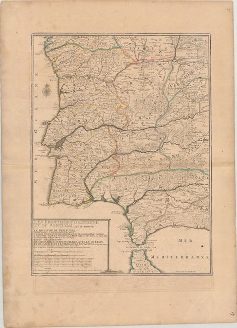
Subject: Spain & Portugal

Period: 1705 (dated)

Publication: Atlas ou Recueil de Cartes Geographiques…

Color: Hand Color

Size:
16.9 x 22.6 inches
42.9 x 57.4 cm
Download High Resolution Image
(or just click on image to launch the Zoom viewer)

This detailed map of Portugal and southwestern Spain is divided into provinces and filled with rivers, roads, and place names. Lisbon, Madrid, Seville, and numerous other large cities are depicted with miniature bird's-eye views. The title cartouche lists the longitudes and latitudes of the major cities. Engraved by P. Starckman.

References: Pastoureau, FER II C [72].

Condition: B

Contemporary outline color on a lightly toned sheet with wide margins and the watermark of the Maltese cross encircled by rosary beads. There is light offsetting, a few printer's creases, and minor soiling.

Estimate: $300 - $375

Unsold

Closed on 9/14/2022

Archived