Subject: La Rochelle, France
Period: 1717 (circa)
Publication: Theatri Europaei...
Color: Black & White
Size:
13.5 x 10.6 inches
34.3 x 26.9 cm
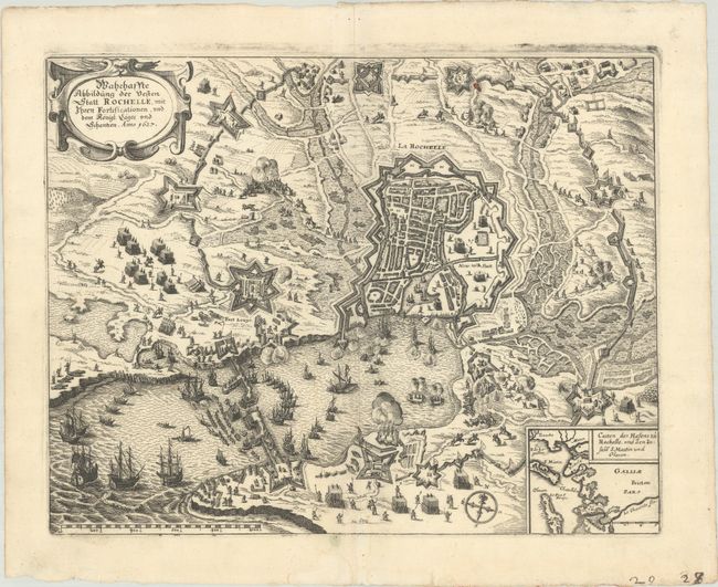
This dramatic and exquisitely engraved city plan details the fortifications of La Rochelle during the siege of 1627-28, the culmination of the fighting between French Catholics and Protestants during the 1620s. A crucial Huguenot stronghold, La Rochelle was blockaded by French royal troops under the command of Cardinal Richelieu for 14 months from September 10th, 1627 to October 28th, 1628. During the siege, the population of the city plummeted from 27,000 to 5,000, leading to an unconditional surrender. The plan renders the fighting around the city in striking detail. An inset map at bottom right zooms out to show the surrounding coastal region. The map is adorned by a decorative strapwork title cartouche, compass rose, and distance scale.
References: Shirley (BL Atlases) G.MERI-16a #37.
Condition: A
A sharp impression on a sheet with a coat of arms watermark. There is a small paper flaw at top right and faint dampstaining that enters the engraved image at bottom.