Subject: North Pole, Greenland
Period: 1684-1702 (circa)
Publication:
Color: Hand Color
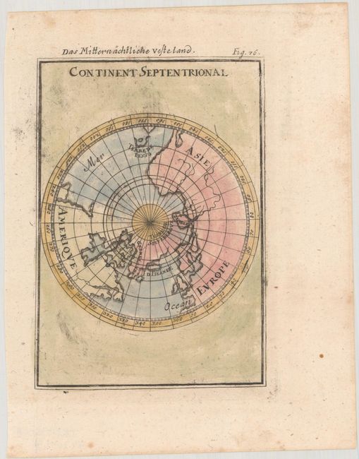
A. Continent Septentrional, by Alain Manesson Mallet, from Beschreibung des Gantzen Welt-Kreisses…, circa 1684 (4.2 x 5.9"). Miniature map of the North Pole on a polar projection with only the landmass outlines shown and named. The northern tip of the Island of California is shown, as well as Terre de Jesso, which is prominently named. Reference: Pastoureau, Manesson-Mallet I B. Condition: There is some minor printer's ink residue in the image. (A)
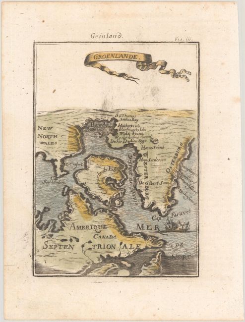
B. Groenlande by Alain Manesson Mallet, from Beschreibung des Gantzen Welt-Kreisses…, circa 1684 (4.2 x 5.9"). An interesting miniature map of Greenland and northern Canada. Place names are only shown in Greenland. The sea is fully engraved and two ships are shown in battle. Title is in a ribbon cartouche. Reference: Pastoureau, Manesson-Mallet I B. Condition: There is some minor printer's ink residue in the image. (A)
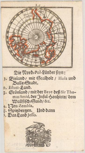
C. Die Nord-Pol-Lander..., by Mueller/Bodenehr, from Kurtbuendige Abbild-und Vorstellung der Gantzen Welt, published 1702 (3.1 x 2.6"). This map depicts the North Pole. It is based upon Johann Christoph Hoffman's map of the region published in 1678. The double Hudson Bays are more exaggerated in this projection, and a small river on the Labrador coast is omitted. This is the second state with I.c above the top border. German text below the map. References: Burden #688; King (2nd ed.) pp.160-61. Condition: Dark impression on a mostly clean sheet that has been trimmed to inside the map image at left. (B)
References:
Condition:
See description above.