Subject: Netherlands
Period: 1589 (dated)
Publication: Omnium Belgii, sive Inferioris Germaniae Regionum Descriptio...
Color: Hand Color
Size:
14.5 x 10.2 inches
36.8 x 25.9 cm
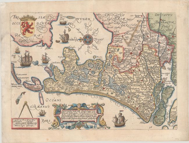
This exquisite map of Holland was the first cartographic work by the Dutch Mannerist painter, printmaker, and engraver Jan Pieterszoon Saenredam (1565-1607). It features excellent detail of the region's watershed and names several towns and cities, including Amsterdam, the Hague, Utrecht, and Rotterdam. The map is rich with decorative elements, among them several sailing ships, a sea monster, an intricate strapwork title cartouche, a distance scale cartouche mounted by dividers, and a leonine coat of arms. An elaborate compass rose orients the north to the left. This is the third state of the map, with the number 36 engraved at bottom right and slight cracks in the plate near the coat of arms and in the title cartouche. It appeared in one of Willem Blaeu's editions of Lodovico Guicciardini's book on the Low Countries, published in 1612 and 1613. Blank verso.
References: Shirley (BL Atlases) G.GUIC-3b.
Condition: A
A crisp impression on watermarked paper with a few small spots and minor archival repairs in the margins.