Subject: Baltic Sea
Period: 1650 (circa)
Publication: Nouvel Atlas
Color: Black & White
Size:
21.5 x 16.7 inches
54.6 x 42.4 cm
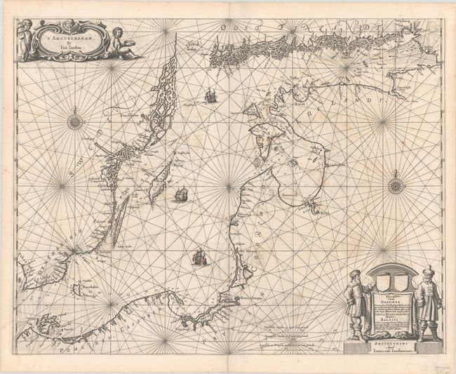
A scarce sea chart of the Baltic Sea, extending from Kalingrad and Riga to just past Stockholm and into the Gulf of Finland. The islands of Gotland, Bornholm, Rugen, Oland, and Oesel are delineated, and there is excellent detail of the coastlines with rivers and inlets named and depth soundings given. There are two decorative compass roses orienting the map, and thee ships grace the sea. The title is attended by a pair of fishermen with their catch in the lower right, and Jansson's imprint appears in a cartouche at top left flanked by cherubs holding navigational tools. French text on verso, published between 1650-57.
References: Tooley (MCC-71) #349; Van der Krogt (Vol. I) 0250:1.
Condition: B+
A dark impression on a bright sheet with light, scattered foxing, a crease adjacent to the centerfold at top, and archival repairs along the centerfold at top and bottom.