Catalog Archive
Auction 189, Lot 404

"A Chart of the Seacoasts of England Flanders & Holland Shewing All the Sands Shoars Rocks and Dangers...", Anon.

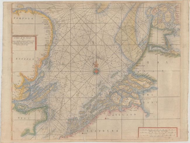
Subject: North Sea, England & Low Countries

Period: 1710 (circa)

Publication:

Color: Hand Color

Size:
20.9 x 16.9 inches
53.1 x 42.9 cm
Download High Resolution Image
(or just click on image to launch the Zoom viewer)

This detailed sea chart covers the North Sea and the coasts of England, Belgium, and the Netherlands with great detail of the shoals, navigational hazards, bays, harbors, lighthouses, roads, forts, and castles. The map is based on John Sellers' map of the same title and is virtually identical to Samuel Thornton's chart published in his The Sea-Atlas (ca. 1702-07), except with no attribution in the title cartouche. The title in enclosed in a simple cartouche, and the chart is centered on a large compass rose.

References:

Condition: B+

There is light soiling and printer's ink residue. A couple of edge tears have been professionally repaired on verso.

Estimate: $400 - $475

Sold for: $200

Closed on 9/14/2022

Archived