Subject: Peru
Period: 1630 (circa)
Publication:
Color: Hand Color
Size:
19.1 x 14.8 inches
48.5 x 37.6 cm
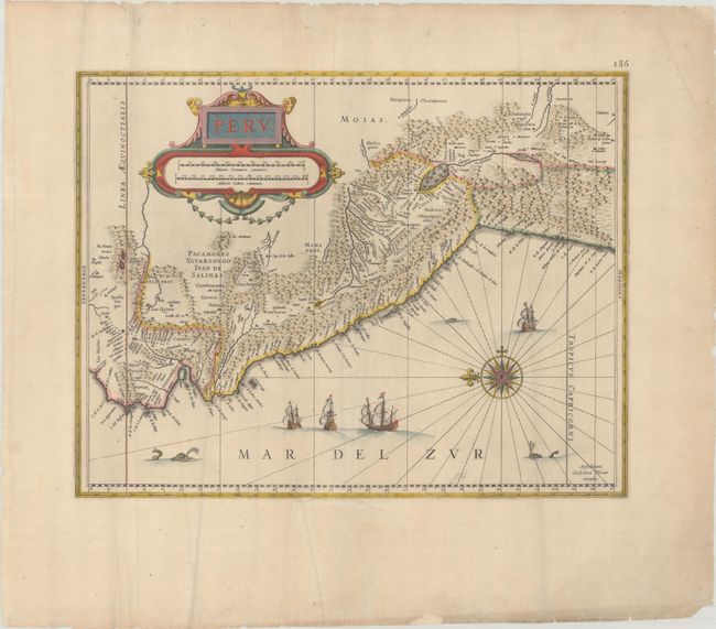
Beautifully engraved map based on the cartography of Hessel Gerritsz. The map covers the Pacific coast of South America from Ecuador as far south as the Atacama Desert in the northern reaches of Chile. It includes the Potosi silver mines, Titicaca, Cusco, Quito and numerous other towns and villages. The dramatic strapwork cartouche incorporates both the title and the distance scales. A large compass rose orients the map with north to the left. It is further decorated with four Spanish galleons and three sea monsters. This is one of the plates that Blaeu acquired from the widow of Jodocus Hondius in 1629. Blank verso.
References: Van der Krogt (Vol. II) #9820:2.2.
Condition: B+
A nice impression on a wide-margined sheet with the watermarks of "1B" and "VE" with some extraneous creasing and minor soiling. There are archival repairs to a small hole at bottom, a 3" tear below the image, and a number of tiny chips and tears along the edges of the sheet.