Subject: Rio de la Plata
Period: 1815 (dated)
Publication:
Color: Hand Color
Size:
34.5 x 22.1 inches
87.6 x 56.1 cm
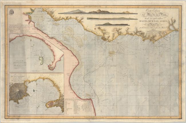
This remarkably detailed sea chart of the mouth of the Rio de la Plata is based on the surveys of Don Andres de Oyarvide. There is plenty of navigational information, including depth soundings, bottom types, banks, anchorages, and more. Place names and topographical detail line the coast, which extends from San Clemente del Tuyu in the south to Laguna de Rocha in the northeast. Buenos Aires and Montevideo are both located. A trio of coastal views appear at top. Two inset charts at left depict the areas surrounding Maldonado and Montevideo. A key at top left explains the various symbols used on the chart, and another at bottom identifies the various bottom types. Oyarvide's survey (1800-03) was the first major survey of the region since the Malaspina expedition (1789-94). This edition is corrected and updated to 1815.
References:
Condition: B
On a sheet that has been backed with archival tissue with moderate soiling, dampstaining at right, and a number of archivally repaired tears along the left border and at lower right. There is an abrasion in the border at bottom right.