Subject: Central South America, Paraguay
Period: 1631 (published)
Publication: Appendix Theatri...
Color: Black & White
Size:
18.9 x 14.8 inches
48 x 37.6 cm
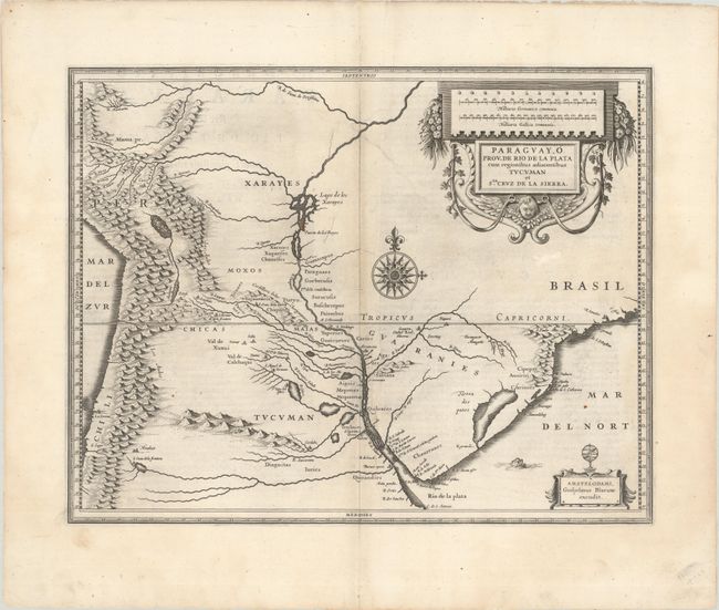
Superb map of the region including the Paraguay River basin and the Peru-Chilean coast with Lake Titicaca. The Rio de la Plata is boldly shown with many large islands in the broad river. The mythical Lago de los Xarayes is featured on the map, which was believed to connect the Rio de la Plata and Amazon River systems. Several towns are named including R. Ianeiro, S. Paulo, Buenos Ayres, Corduba, Medoca, Arica, Potosi and Cusco. A large decorative title cartouche incorporates the distance scales, while a smaller cartouche features an armillary sphere. A fine, large compass rose with fleur-de-lys also adorns the sheet. Latin text on verso.
References: Van der Krogt (Vol. II) #9900:2A.2.
Condition: A
A dark impression with minor offsetting, a few printer's creases along the centerfold, and a couple tiny rust spots.