Subject: Brazil
Period: 1822-35 (circa)
Publication:
Color: Hand Color
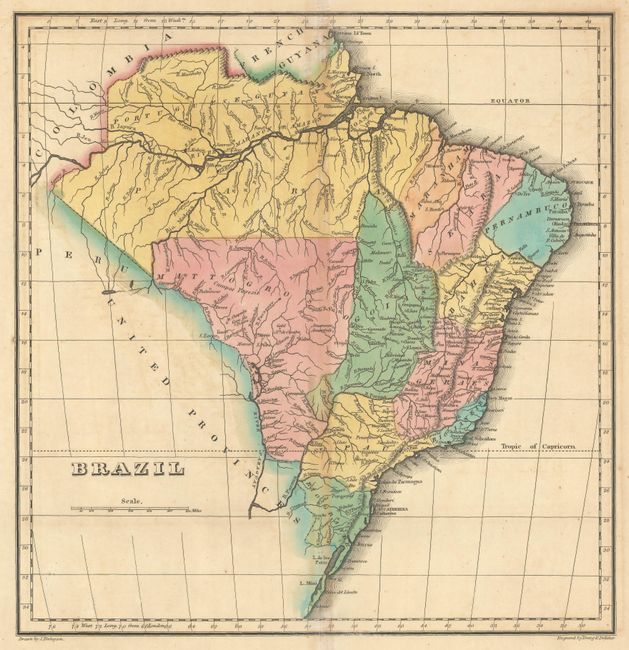
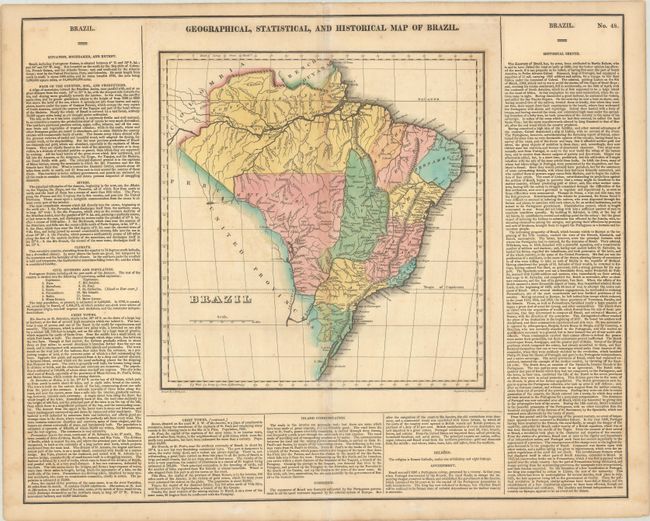
A. Geographical, Statistical, and Historical Map of Brazil, by Carey & Lea, from A Complete Historical, Chronological, and Geographical American Atlas..., published 1822 (11.3 x 11.6"). This attractive and detailed map of Brazil divides the area into Portuguese Guiana and 12 capitanias. It is surrounded by English text describing the region and its history. The map was published on the cusp of Brazilian independence; as the final line of the "historical sketch" notes, "The absolute and formal independence of this country on Europe, appears to be an event not far distant." Drawn by J. Finlayson and engraved by Young & Delleker. The map is on a full folio sheet (22.3 x 17.8") with English text. Condition: Full contemporary color on a sheet with light toning that is a bit more pronounced along its centerfold. There are a few edge tears, an archivally repaired centerfold separation at top, light offsetting, and a tiny hole along the map border at left.
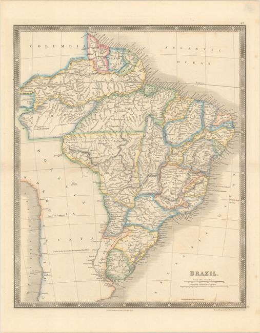
B. Brazil, by John Dower, from A New General Atlas, circa 1835 (13.4 x 16.3"). This handsome atlas map of Brazil extends to include the Guianas, Paraguay, and Uruguay. It shows political divisions, towns and cities, and nice topographical detail. Part of Colombia and the area west of the Paraguay and Parana rivers is left mostly blank, with the exception of a scattering of place names. The map is surrounded by a decorative keyboard-style border. Published by Henry Teesdale & Co. Condition: Contemporary color with a few light spots.
References:
Condition: B+
See description above.