Subject: Venezuela
Period: 1710 (circa)
Publication:
Color: Hand Color
Size:
19.3 x 14.8 inches
49 x 37.6 cm
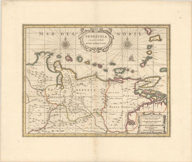
This beautifully engraved map is based on the cartography of Hessel Gerritsz. It covers the northern coast of South America, Venezuela, east to the mouth of the Orinoco, and includes the offshore islands from Aruba through Dominica and Tobago. The fine engraving illustrates the mountains, forests, rivers and missions in the interior, but shows place names primarily along the coastlines owing to the relatively few explorations made into the interior. The map is richly embellished with title and distance scale cartouches, compass roses and a galleon. Engraved by E.S. Hamers-veldt and S. Rogeri and first issued by Henricus Hondius; this being the Valk & Schenk edition.
References: cf. Van der Krogt (Vol. I) #9830:1.1.
Condition: B+
A crisp impression with contemporary outline color on a sheet with wide margins. There is light offsetting, a tiny hole in the image, and a hint of toning along the centerfold.