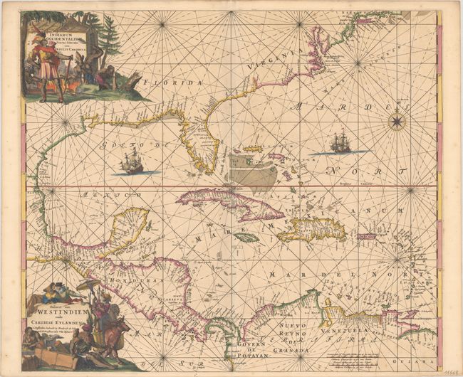
Subject: Gulf of Mexico & Caribbean
Period: 1675 (circa)
Publication:
Color: Hand Color
Size:
22.1 x 19.1 inches
56.1 x 48.5 cm
This is the scarce first edition of one of the most beautifully engraved maps of the West Indies. It extends to show the coastline of North America nearly to New England, all of Central America, and the northern coastline of South America. There is a wealth of navigational information including passages, anchorages, sandbanks, and shoals. Numerous place names line the coasts, including Charleston, St. Augustine, Cape Canaveral, Roanoke Island, Santo Domingo, and Havana. The curvature of the Gulf Coast is close to accurate, but the chart predates the Iberville and La Salle's explorations of the Mississippi Delta and Mobile Bay. The chart is a masterpiece of decorative engraving with illustrations of sailing vessels, a compass rose, and two elaborate title cartouches (Latin and Dutch), one showing cannibalism and the other depicting European pirates observing natives.
References: Burden #468.
Condition: A
A sharp impression with full contemporary color and minor foxing. Small remnants of hinge tape on verso.