Subject: United States & Mexico
Period: 1863 (published)
Publication: Atlas Universel de Geographie Ancienne et Moderne...
Color: Hand Color
Size:
16.7 x 13.3 inches
42.4 x 33.8 cm
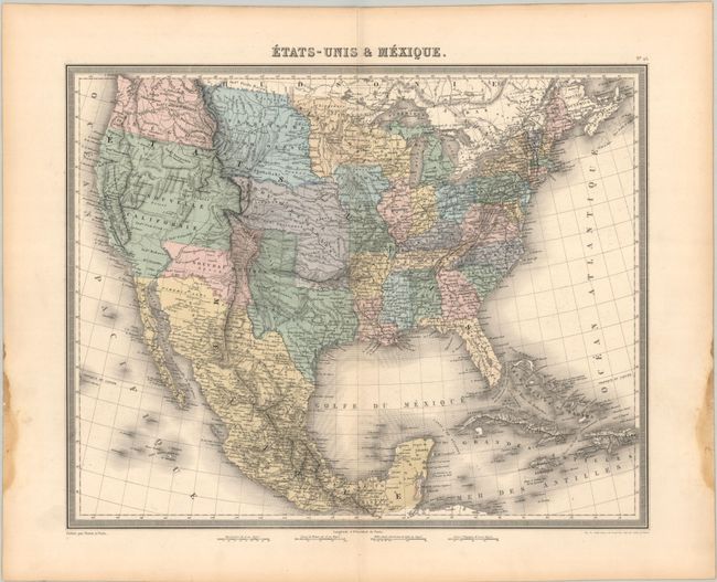
This detailed and intricately engraved map shows the newly acquired land In the western United States at the conclusion of the Mexican-American War. It shows a large Northwest Territory, Indian Territory, and Oregon Territory (extending into Canada). Most of the west is labeled Nouvelle California, with a pre-Gadsden border. Texas appears with its pre-Missouri Compromise holdings. Mormonfort is located right on the Great Salt Lake, also referred to here as Trmpanogos [sic]. Remarkable detail throughout including Indian names, watershed, railroads, forts, roads, etc. It locates many Indian tribes and Spanish missions in the West. A very nice map that shows a transitional period between the Mexican-American War and the eventual settlement of the Canadian boundary dispute between the U.S. and Britain. Surrounded by a decorative keyboard-style border. Published by Furne. Although the cartography reflects the region as it was in the late 1840s, it was published in a beautiful (but decidedly out-of-date) French atlas in 1863.
References: Rumsey #4697.029.
Condition: A
Contemporary color with dampstains in the left and right blank margins, well away from map iamge.