Subject: Oklahoma
Period: 1903 (published)
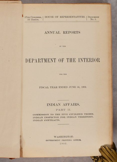
Publication: H.R. Doc. 5, 57th Congress, 2nd Session
Color: Printed Color
Size:
5.9 x 9.2 inches
15 x 23.4 cm
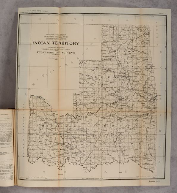
This is the ninth annual report of the Commission to the Five Civilized Tribes, with additional reports by the Indian Inspector to the Indian Territory, and an extensive listing of proposals received and contracts awarded for the Indian Service. The volume is well-illustrated with single-page plates, tables, and folding maps. Of particular interest is the map of Indian Territory (18.0 x 20.0") by Charles Fitch which matches the configuration of the rare State of Sequoyah, which the Indian Nations attempted to create in 1905 in an effort to thwart the expansive tendencies of the United States. It is also similar to the rare 1896 Senate edition which was issued in printed color. The regions of the Chickasaw, Choctaw, Creek, Seminole, Cherokee, and several other Indian tribes are named. The Territory of Okalahoma hovers ominously in the northwest. Fitch was the topographer in charge of the Indian Territory Surveys. The full listing of maps in the volume include:
A. Indian Territory, dated 1898, black & white (18.0 x 20.0").
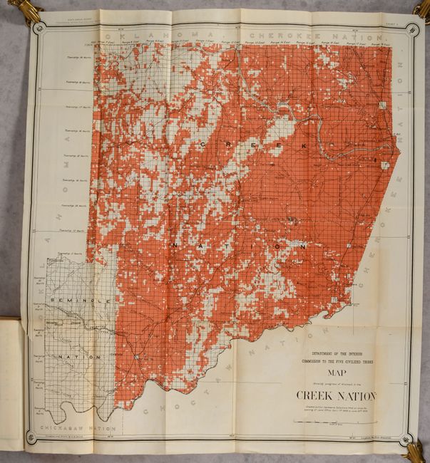
B. Map Showing Progress of Allotment in the Creek Nation, dated 1902, printed color (27.0 x 29.8").
C. Map of Seminole Nation, printed color (9.3 x 15.3").
D. Indian Territory - Progress of Sub-Division Survey, dated 1902, printed color (18.0 x 19.9").
E. Indian Territory Showing Railroad Systems, dated 1902, printed color (15.3 x 17.6").
F. Indian Territory. Showing Townsites Approved to June 30-1902, dated 1902, printed color (16.8 x 18.8").
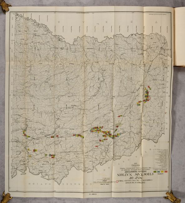
G. Map of Choctaw Nation Indian Territory, dated 1900, printed color (25.0 x 28.0").
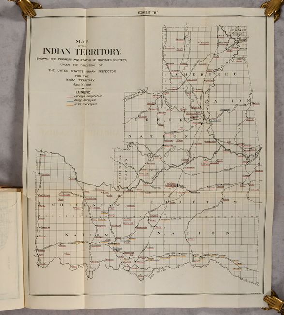
H. Map of the Indian Territory. Showing the Progress and Status of Townsite Surveys..., dated 1902, printed color (17.8 x 21.0").
I. Map of the Indian Territory. Showing the Progress and Status of Townsite Appraisements..., dated 1902, printed color (18.0 x 21.0").
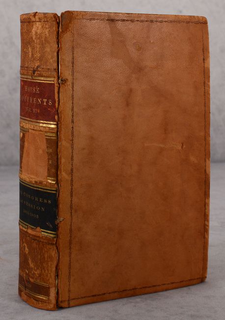
764 pages. Hardbound in contemporary leather with title labels on the spine.
References:
Condition: B+
The maps are very good to near fine with a few short binding tears, several short fold separations, and faint color offsetting. Text and plates are clean, bright and near fine. The front cover has almost separated, and the covers are moderately worn. The title label on the spine has partially chipped off.