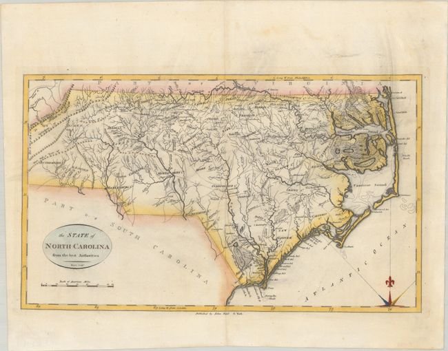
Subject: North Carolina
Period: 1796 (circa)
Publication: The American Atlas
Color: Hand Color
Size:
18.3 x 10.9 inches
46.5 x 27.7 cm
This early map of the state locates wagon roads, settlements, rivers, and mountains, as well as many swampy areas including the Great Dismal Swamp, Alligator Swamp, and the Great Green Swamp. Counties are named but the borders are not delineated. The area around present-day Forsyth County is identified with a dotted line, showing the boundaries of the Moravian Community of Wachovia. This is the first state of the map. Engraved by Benjamin Tanner and published in Reid's' American Atlas.
References: Wheat & Brun #587; Phillips (Atlases) #1216-16.
Condition: A
A nice impression on a sheet with the watermarks of "J. Kool" and a fleur-de-lis coat of arms. There is some light printer's ink residue and faint dampstain confined to the top blank margin.