Catalog Archive
Auction 189, Lot 25

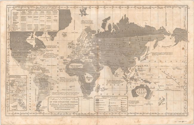
"Moral & Political Chart of the Inhabited World; Exhibiting the Prevailing Religion Form of Government, Degree of Civilization, and Population of Each Country", Woodbridge, William Channing

Subject: World

Period: 1826 (dated)

Publication:

Color: Black & White

Size:
17.4 x 10.6 inches
44.2 x 26.9 cm
Download High Resolution Image
(or just click on image to launch the Zoom viewer)

This thematic world map reflects the prevailing prejudiced concepts of morality and civilization in the West in the 19th century. The map divides the world by "degree of civilization": Savage, Barbarous, Half-civilized, Civilized, and Enlightened. It also indicates type of government and predominant religions. A table at top left provides figures on the distribution of races and religions as of 1826. William Channing Woodbridge (1794-1854) was a geographer and educational reformer who made great strides in geographic education and teaching women and the deaf. This map appeared in various editions of his School Atlas and Modern Atlas between 1821 and 1843. It is an interesting document of the vulgar anthropology prevalent during that era, with its racist, condescending, and pseudo-scientific ideas. For more information on this fascinating map, check out this blog post from Worlds Revealed: Geography & Maps at the Library of Congress.

References:

Condition: B

There is scattered foxing and soiling, minor extraneous creasing in the corners, and a few edge tears, including two at bottom that have been closed with tape on verso.

Estimate: $100 - $130

Sold for: $95

Closed on 9/14/2022

Archived