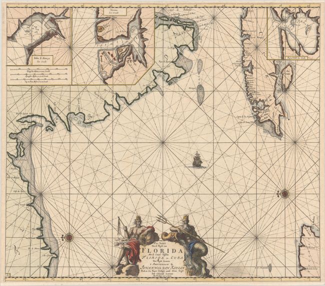
Subject: Florida & Cuba
Period: 1682 (circa)
Publication: De Nieuwe Groote Lichtende Zee-Fakkel, Part IV.
Color: Hand Color
Size:
23 x 20.3 inches
58.4 x 51.6 cm
This uncommon chart is believed to be the first sea chart of the eastern portion of the Gulf of Mexico, and shows Florida's gulf coast from Pensacola to Cape Florida, with the western part of Cuba. The cartography is based in part on Hessel Gerritsz' chart circa 1631, and nearly all the place names on the chart are Spanish. The chart is oriented with north to the left, with a bit of the Yucatan Peninsula shown at lower right. Three insets depict the Cuban harbors: Matanzas Bay, Havana Harbor and Hondo Bay. The elaborate cartouche is flanked by Neptune, god of the sea, and one of the wind gods. This is the second state, with the plate number "15" added at bottom left.
References: Burden #591; Martin & Martin, p. 84-85.
Condition: A
A sharp impression with a bit of printer's ink residue to the right of the title cartouche and a minor centerfold separation at bottom that has been professionally repaired. Narrow top and bottom margins have been professionally extended to better accommodate framing.