Subject: Colorado
Period: 1878 (published)
Publication: Tenth Annual Report of the United States Geological and Geographical Survey of the Territories, Embracing Colorado and Parts of Adjacent Territories...
Color: Printed Color
Size:
35.1 x 25.3 inches
89.2 x 64.3 cm
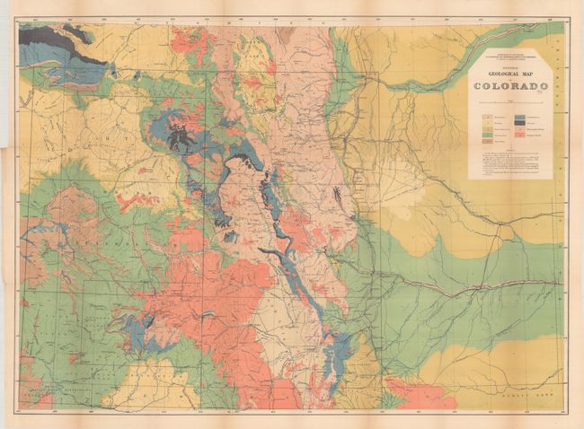
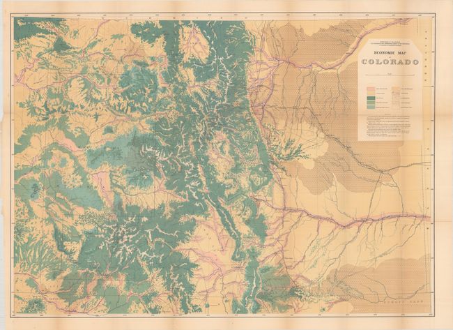
This lot includes two maps from Hayden's field work in Colorado:
A. General Geological Map of Colorado. This is the first published geological map of Colorado, and is color-coded to show 9 different geological groups. In addition to the fine geological data, the base map shows good detail of towns and settlements, rivers, railroads, mountain peaks, and more. Condition: There are two fold separations that have been closed on verso with archival tape and a number of small splits at the junctions. (B+)
B. Economic Map of Colorado. This beautifully executed map details the land types of the region. The map covers the area from North Park in the north to Ft. Garland in the south, and extends from Mt. Peale in the west to Ft. Lyon in the east. A legend identifies land types including agricultural and pasture lands, forest and bad land. Coal lands, and gold and silver districts are identified. Condition: There is some light toning along the folds and a number of separations at the fold junctions.
Each of these maps also correspond to sheets included in Hayden's famous Geological and Geographical Atlas of Colorado published in 1877 and 1881. These maps are considered the best mapping of the period and laid the foundation for the mapping of Colorado.
References:
Condition: B+
Issued folding. See description above.