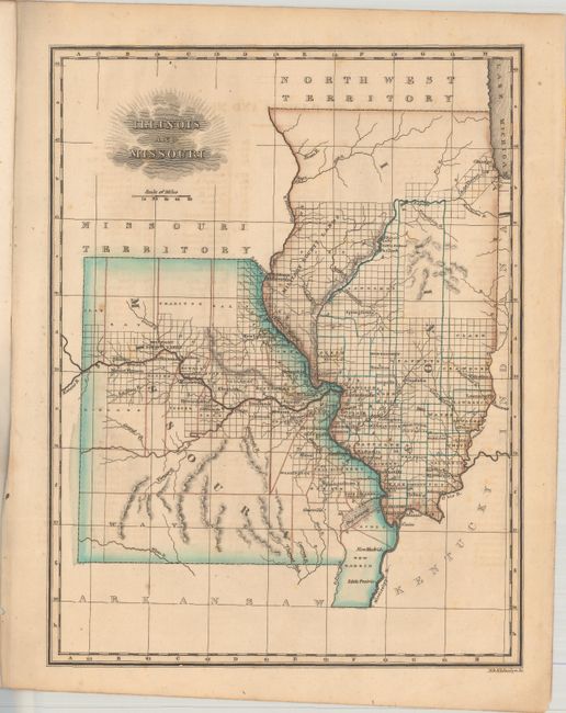
Subject: Illinois & Missouri
Period: 1823 (circa)
Publication: An Atlas of the United States
Color: Hand Color
Size:
7.6 x 9.9 inches
19.3 x 25.1 cm
A detailed map showing the extent of development in the region. While much of Illinois has been surveyed, most of Missouri is still frontier lands with development adjacent to the Missouri River. Military Bounty Lands are identified in western Illinois along the Mississippi River and above Jefferson City, Missouri. County lines, county seats, forts, rivers, and topography are shown. Engraved by N. & S.S. Jocelyn. Accompanied by an index sheet listing counties and cities on the map.
References: Rumsey #4869.
Condition: B+
There are a few spots of foxing and light offsetting from an opposing page of text. Binding holes are confined to the left blank margin.