Subject: Colonial New England & Mid-Atlantic United States
Period: 1740 (circa)
Publication: Modern History
Color: Hand Color
Size:
10.9 x 8.1 inches
27.7 x 20.6 cm
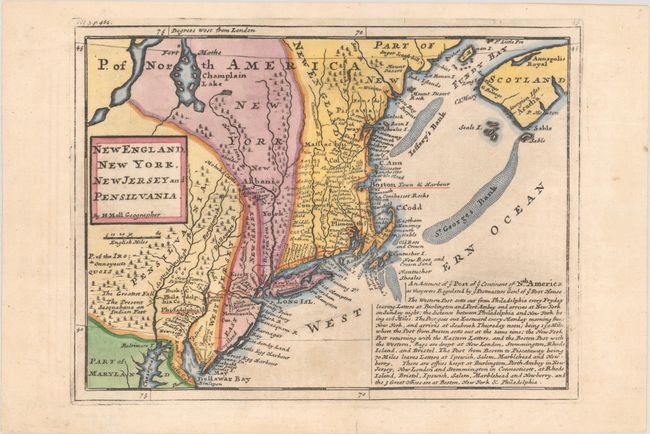
First state of this map of New England and one of the earliest Post Road maps. The postal road is shown extending from Portsmouth, New Hampshire along the coast to New York and turning west to the Delaware River and Philadelphia. New York is confined to a narrow strip along the Hudson River and New Jersey is divided into West and East New Jersey. A fascinating account of the post routes in the colonies fills part of the map - "The Western Post setts out from Philadelphia every Fryday, leaving letters at Burlington and Pert Amboy and arrives at New York on Sunday night..." Published in Thomas Salmon's Modern History: or the Present State of All Nations.
References: McCorkle #729-2, Shirley (BL-Atlas) G.SALM-1c #44.
Condition: A
There are a few minor spots at bottom, else fine. The sheet has been backed with tissue.