Subject: United States
Period: 1850 (circa)
Publication:
Color: Hand Color
Size:
16.3 x 12.3 inches
41.4 x 31.2 cm
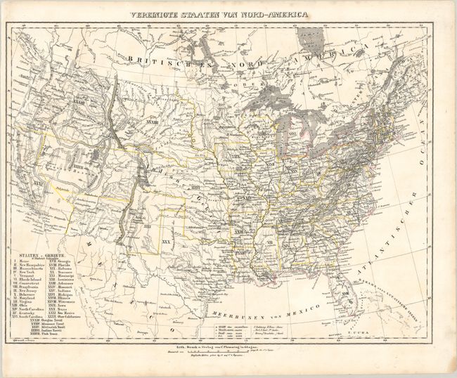
This German map provides an excellent view of the evolving American West with some unusual territorial configurations. Texas has been updated to show its present-day borders, which results in a very odd looking Indian Territory that stretches northwest to the North Platte River and includes present-day Kansas and parts of present-day Nebraska, Colorado, and Wyoming. New Mexico Territory appears between the Sierra Madre Mountains and Texas' western border, with the Arkansas River as its northern boundary. A vast Utah Territory is depicted between the Sierra Nevada and Sierra Madre ranges. Although Ober-Californien is identified as XXXII in the key, the unusually truncated California depicted on the map is numbered XXXI, suggesting it is part of New Mexico. Missouri Territory takes up most of Montana and parts of Wyoming, while Oregon Territory incorporates Washington. The U.S.-Mexico border predates the Treaty of Guadalupe Hidalgo. The map depicts towns, missions, forts, railroads, and canals. A table lists the states and territories at lower left.
References:
Condition: A
A few faint spots.