Subject: Colonial Great Lakes
Period: 1780 (circa)
Publication: Atlas de Toutes les Parties Connues du Globe Terrestre...
Color: Hand Color
Size:
12.5 x 8.2 inches
31.8 x 20.8 cm
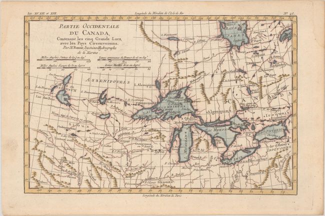
This is the second plate of one of the most interesting maps of the Great Lakes depicting frontier forts, missions, and fur trade routes. It covers the region from James Bay south to show Ft. St. Louis, and from Lake Ontario through the Great Plains. It contains numerous Indian tribe names and forts including Detroit, St. Louis, Toronto and Chicagou. Lake Superior contains Isle Royale, as well as the phantom islands of St. Anne, Maurepas and Ponchartrain, which were reported by the Jesuit explorer Charlevoix. The Keweenaw Peninsula is noted as Pt. de Kiaonan. The source of the Mississippi is noted as inconue or unknown.
References: Kershaw #974; Sellers and Van Ee #173.
Condition: A
A crisp impression with a touch of printer's ink residue and light dampstaining that is only visible in the blank margins.