Subject: Northeastern United States & Canada
Period: 1785 (dated)
Publication: Political Magazine
Color: Black & White
Size:
23.9 x 18 inches
60.7 x 45.7 cm
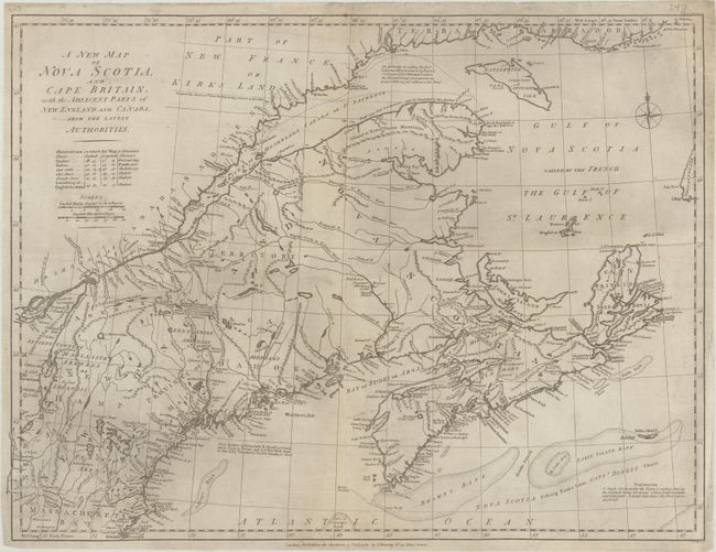
This map appears to be based upon Thomas Jeffreys' earlier map of the region first issued in 1755. It includes New England as far south as Boston, the St. Lawrence River up to Montreal, and as far north as the southern coastline of Labrador. The boundary between Nova Scotia and New England begins at the Penobscot River and then along a dotted line straight north, roughly according to the Treaty of Versailles. It provides an excellent view of the region with detail of the settlements, roads, forts, Indian nations, fishing banks, and notations. Engraved by John Lodge and published in the July 1785 issue of Political Magazine.
References: Jolly #POL-91; Sellers & Van Ee #188.
Condition: B+
Issued folding and now flat with professional repairs to a few small fold separations and edge tears. There is some light surface soiling.