Catalog Archive
Auction 189, Lot 108

"Karte von den Nord-Westlighen Theilen von America nach Middletons und Ellis Reisen im t 1742 und 1746...", Bellin, Jacques Nicolas

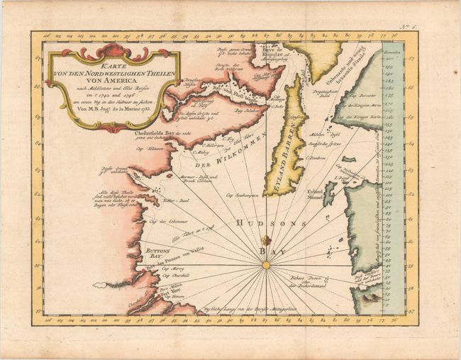
Subject: Hudson Bay, Canada

Period: 1753 (dated)

Publication: Allgemeine Historie der Reisen zu Wasser und Land…

Color: Hand Color

Size:
10.6 x 8.1 inches
26.9 x 20.6 cm
Download High Resolution Image
(or just click on image to launch the Zoom viewer)

Very nicely engraved chart that covers most of Hudson Bay. It locates Fort Prince of Wales and Fort York, the Ottawa Islands (here the Bakers Dozen), the track of Henry Ellis in 1746, Repulse Bay, Buttons Bay, and more. Middleton explored Wager Inlet, Repulse Bay, and the northern part of Roes Welcome in search of a Northwest Passage via Hudson Bay in 1746. The map includes a large and decorative title cartouche at top left. From a German edition published in 1758 by Johann Joachim Schwabe.

References: Kershaw #457.

Condition: A

A crisp impression on watermarked paper, issued folding with minor toning.

Estimate: $140 - $170

Unsold

Closed on 9/14/2022

Archived