Subject: Northern Canada & Greenland
Period: 1680 (circa)
Publication:
Color: Hand Color
Size:
22.3 x 19.2 inches
56.6 x 48.8 cm
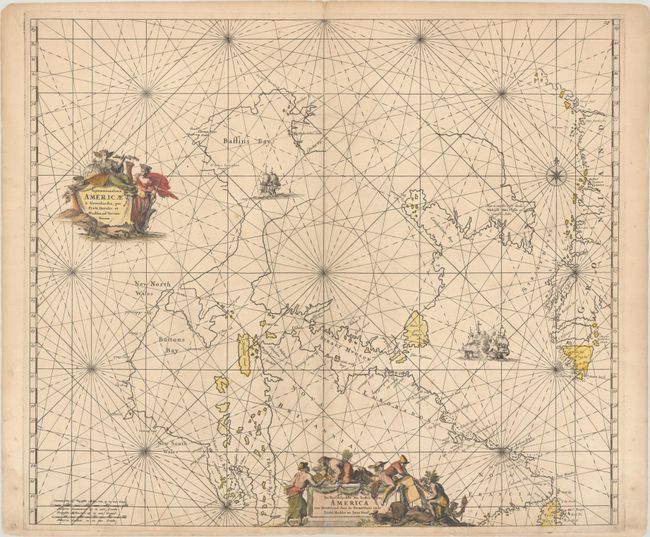
This is the second state of De Wit's fine chart of Hudson Bay and Arctic Canada, with plate number 25 at top right. The beautifully engraved chart was based on Van Loon's important chart of 1666 and includes Hudson Bay and Strait, Baffin Bay, and the western coast of Greenland. It shows an erroneous second bay next to James Bay named The Great Bay (an exaggeration of Rupert Bay), and Mansel Island is named as Mansfeld Island. The chart is richly embellished with a sailing ship, rhumb lines, and two elaborate cartouches - the second with a Dutch title.
First published circa 1675, de Wit's sea atlas, Orbis Maritimus ofte Zee Atlas, contained 27 charts from the North Pole to North and South America. The charts all appear to have been engraved by Romain de Hooghe and are splendid examples of Dutch marine works. The atlas was reprinted with amendments by Louis Renard in 1715, by Reinier and Josua Ottens in 1739 and 1745, and finally by the widow of van Keulen in 1802.
References: Kershaw #210.
Condition: B+
A nice impression with full contemporary color, light soiling, and light toning along the centerfold and edges of the sheet. There are archival repairs to two small worm holes near the center of the image, a centerfold separation at bottom, and a 0.5" x 1" chip in the title cartouche with the image replaced in facsimile.