Subject: North America
Period: 1854 (circa)
Publication: Atlas Elementaire Simplifie de Geographie...
Color: Hand Color
Size:
14.8 x 19.2 inches
37.6 x 48.8 cm
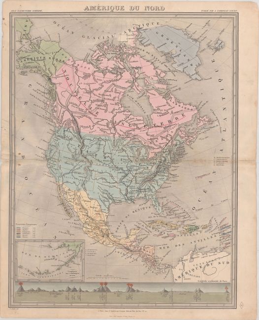
This attractive map of the continent shows some evolving territorial configurations in the west with large Utah and New Mexico territories and both Oregon and Washington territories extending to the Rocky Mountains. Nebraska Territory extends from Kansas Territory north to the Canadian border, and New Mexico Territory includes the Gadsden Purchase. There is little detail in the map with only major rivers, mountains, and a handful of cities identified. Alaska is Amerique Russe with an inset of the Aleutian Islands at lower left. A key at lower left identifies colonial possessions in the Caribbean and a comparative view of mountains is presented at bottom. Drawn by E. Soulier.
References:
Condition: B+
There is minor soiling and short centerfold separations at left and right that have been archivally repaired on verso.