Subject: Atlases
Period: 1735 (circa)
Publication:
Color: Hand Color
Size:
13 x 10.2 inches
33 x 25.9 cm
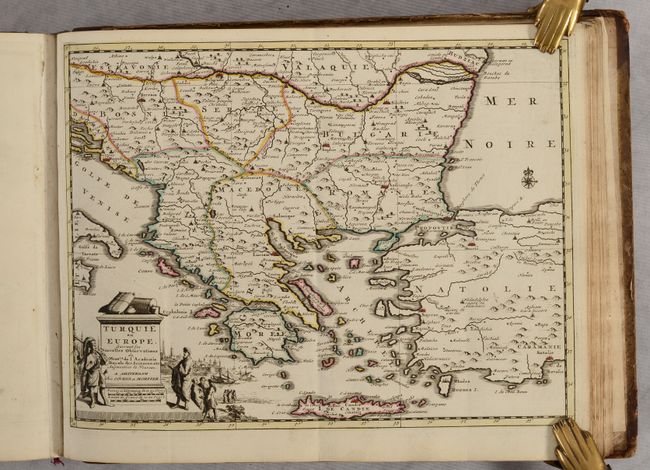
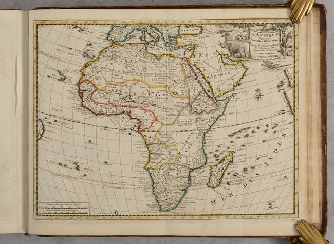
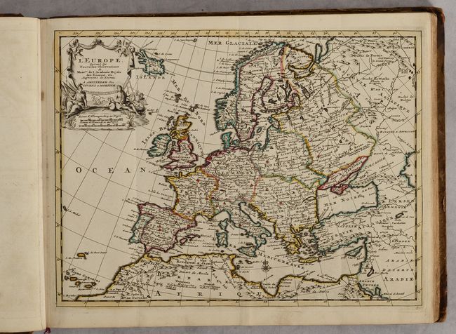
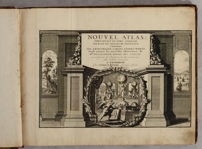
This is Covens & Mortier's reissue of Pieter van der Aa's Nouvel Atlas, which was first published in 1714. The firm of Covens & Mortier acquired many of Van der Aa's plates after his death in 1733. The atlas contains 99 maps with Van der Aa's imprint replaced with that of Covens & Mortier. A few other small changes were made to the plates, such as the title of the map of the Southern United States changed from La Floride to La Louisiane. The majority of the titles end with Suivant les Nouvelles Observations de Mess.rs de l'Academie Royale des Sciences, etc. Augmentees de Nouveau. In addition to maps of the world and 5 continents, there are a celestial chart, 4 maps related to the Americas, 6 maps related to Asia, 1 map related to Africa, and the remaining maps related to Europe. A few of the interesting maps in the atlas are:
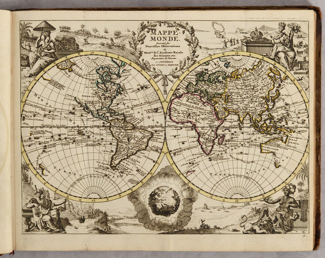
A. Mappe-Monde. Vignettes symbolizing the four continents fill the corners of this double-hemispheric world map. The title cartouche at top is balanced with an interesting representation of the world as it would be seen from space. The map traces the routes of several sixteenth century explorers in the Pacific and Indian Oceans, including Magellan, Tasman, Chevalier de Chermont, Mendana and others. The western coastline of New Zealand is illustrated, along with parts of Australia and Tasmania. Above the peninsular California, the entire northwest coast of North America is blank. There is a remnant of the coastline that suggested a connection between North America and Asia on earlier maps, here with a notation concerning the discoveries of Vasco de Gama.
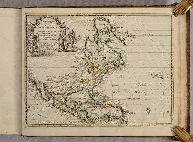
B. L'Amerique Septentrionale. This delicately engraved map of North America and the West Indies is based on Delisle's important map of 1700. It depicts an interesting version of California that is ambiguous about whether it is an island or not, as the Gulf of California is left open ended. The Pacific Northwest is left blank, with nothing shown north of Cape Mendocino. Neptune and two Native Americans flank the large title cartouche. The routes of the explorers Cortez, Drake and Olivier are shown in the Pacific.
C. La Louisiane. This handsome map of the southern United States was based on Delisle's influential Carte du Mexique de la Floride of 1703. The map details early colonial settlements and Indian tribes. The large lake first found on Le Moyne's 1591 map is here called Lac Grande and is land-locked. The Mississippi River is shown too far west of its true course and the Apalachicola River flows from a large spurious lake in present-day Tennessee. Details of part of the Bahamas are included. The Gulf of Mexico is filled with a large cartouche featuring Native Americas and an incongruent lion.
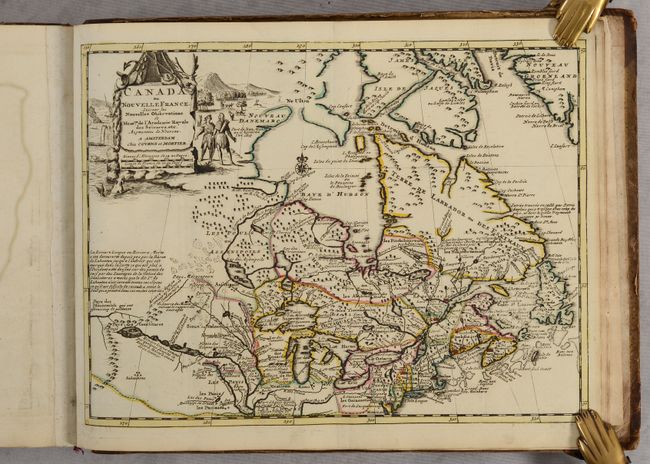
D. Canada ou Nouvelle France. This beautifully engraved map of northeastern North American and the Great Lakes region is based on Delisle's important map of 1703. The Great Lakes are reasonably well delineated, but Hudson Bay and the upper Mississippi River basin are distorted. Lahontan's mythical Riviere Longue is shown linking a large western lake with the Mississippi River. It is thought that the lake's origin is derived from Indian stories concerning the Great Salt Lake. The map is filled with place names, Indian tribes and interesting notations. The large title cartouche is surrounded by scenes of natives and indigenous animals.
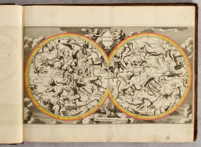
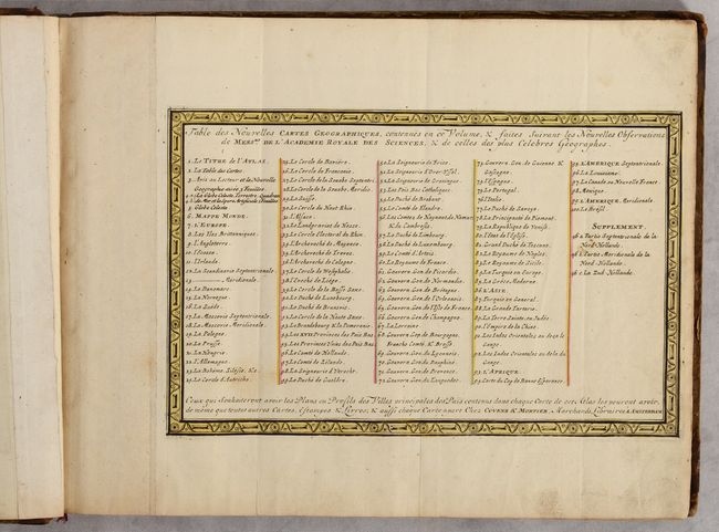
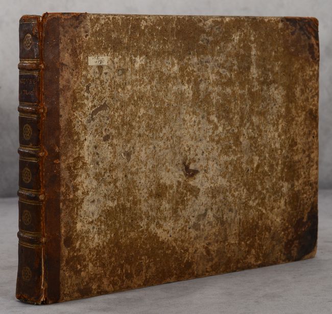
Also included in the atlas are engravings of celestial and terrestrial globes, an armillary sphere, and a wind rose. Oblong quarto. Title page; list of maps; 12 pp. text; 99 maps; 4 engravings on 2 sheets. Hardbound in quarter leather with tips over brown paper covered boards; contemporary spine with 5 raised bands, gilt embossing, and red leather title label; contemporary red ribbon page marker.
References: Shirley (BL Atlases) T.AA-2b.
Condition: A
The maps were originally published in a tall quarto format with the maps folded inward, and have been professionally rebound into an oblong format with the maps flattened. The maps have contemporary outline color with minor occasional soiling. The sheet with the engravings of the wind rose and armillary sphere has some repairs along the center of the sheet where it had previously been bound into the volume. The title page, list of maps, and text are lightly soiled. The covers are heavily abraded and worn with bumped corners and loss of much of the leather at the tips. The spine appears to be contemporary and has some abrasions, cracks, and small chips.