Subject: New Zealand
Period: 1938 (circa)
Publication:
Color: Printed Color
Size:
9 x 13.5 inches
22.9 x 34.3 cm
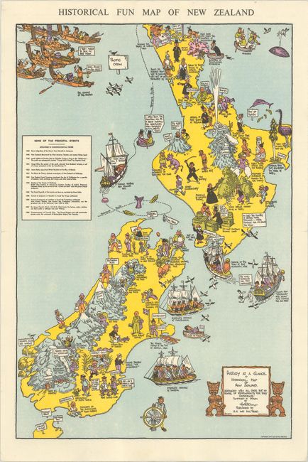
This charming pictorial map of New Zealand packs in nearly 600 years of history. Over 50 historical events and facts are illustrated throughout the map with captions. A short description of each event is on verso. Also on verso is space for a mailing address and stamp so that the map could be folded and mailed. The earliest event listed is the arrival of "The Great Migration" circa 1350, in which Tahitians crossed the Pacific to establish a new home in New Zealand, becoming the ancestors of the Maoris. Many other sites, historical figures, and events in New Zealand's history are commemorated on the map, and a table at left lists some of the most important events. Created by Alan Stuart Paterson and published by A.H. and A.W. Reed by permission of the Lands and Survey Department. A later edition of this map was published to celebrate the 100th anniversary of New Zealand entering the British Commonwealth in 1940.
References:
Condition: A
Clean and bright, issued folding and now flattened with a couple of tiny fold separations that have been archivally repaired.