Catalog Archive
Auction 188, Lot 727
"[Lot of 3] Partie Occidentale de la Nigritie et de la Haute Guinee [and] Partie Orientale de la Haute Guinee [and] Congo ou Basse Guinee", Robert de Vaugondy, Didier
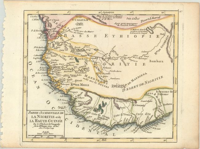
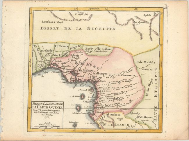
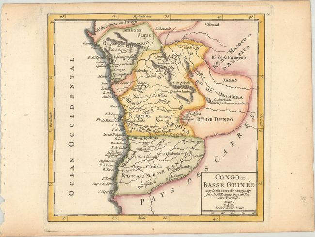
Subject: Western Africa
Period: 1749 (dated)
Publication: Atlas Portatif Universel et Militaire
Color: Hand Color
Size:
6.8 x 6.5 inches
17.3 x 16.5 cm
Download High Resolution Image
(or just click on image to launch the Zoom viewer)
(or just click on image to launch the Zoom viewer)