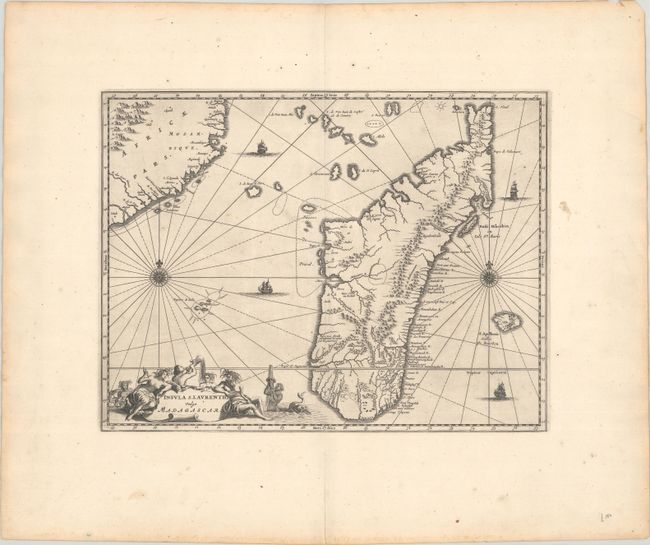
Subject: Madagascar
Period: 1670 (circa)
Publication: Africa: Being an Accurate Description of the Regions…
Color: Black & White
Size:
14.5 x 11.1 inches
36.8 x 28.2 cm
Lovely map of the island of Madagascar and coastline of Mozambique. The interior is largely filled with mountains, and place names are relegated to the coasts and rivers. The map is richly embellished with two compass roses, four sailing ships, and a large title cartouche featuring Poseidon and his sea nymphs. Ogilby based his map directly from Olivier (Olvert) Dapper's map, which was first published in Naukeurige beschrijvinge der Afrikaensche Eylanden.
References: Shirley (BL Atlases) T.OGIL-1a #32.
Condition: A
A dark impression on a sheet with wide margins and a dragon watermark. There is light soiling, most of it confined to the margins, and toning along the edges of the sheet.