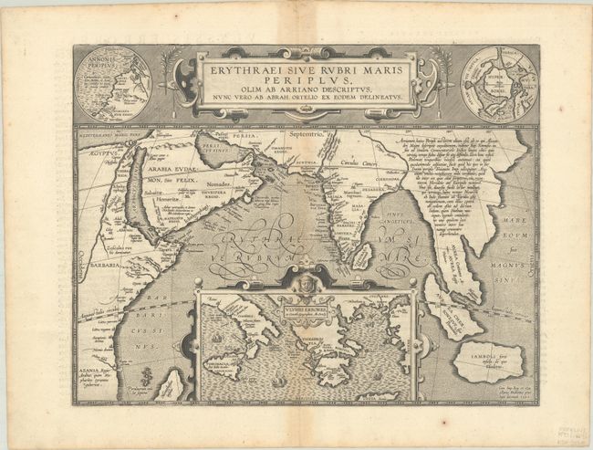
Subject: Southern Asia, Arabia & Eastern Africa
Period: 1597 (dated)
Publication: Theatri Orbis Terrarum Parergon
Color: Black & White
Size:
18.3 x 14.1 inches
46.5 x 35.8 cm
This map from Ortelius' series of historical maps covers from Egypt to Indonesia as far as Java with a large inset of the eastern Mediterranean Sea centered on Greece. In the upper right is an inset of the North Pole (Hyperborei) included by Ortelius to remind his readers that despite recent attempts, a passage to the Far East via the North Pole had not yet been found. To balance the composition Ortelius included an inset of Annonis Periplus in the upper left corner. This map represents the Northwest coast of Africa showing part of the explorations of the ancient King Hanno from Carthogo, who legend says was the first to sail around the continent of Africa to reach the Arabian sea. A very graphic and unusual map with a fully stippled sea. Latin text on verso, published in 1624.
References: Van den Broecke #224.
Condition: B+
A nice impression with a couple of small paper flaws in the margins and light toning along the centerfold and edges of the sheet.