Subject: Japan
Period: 1735 (dated)
Publication: Histoire et Description Generale du Japon
Color: Black & White
Size:
21.5 x 16.6 inches
54.6 x 42.2 cm
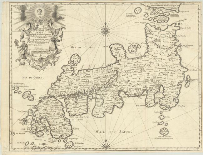
This is the first state of Bellin's influential map made for Jesuit Father Pierre-Francois-Xavier de Charlevoix's Histoire et Description Generale du Japon. Japan is presented basically on the Kaempfer/Scheuchzer model, although Bellin doesn't credit Kaempfer, and instead his sources as the Jesuit Fathers as well as Japanese, Portuguese and Dutch authors. Bellin made several corrections to the coastlines and added place names based on his sources. Of particular interest in this map is the depiction of Kamchatka at top right, separated from Japan by the Detroit de Kamtschatka and a few islands. In the second edition of this map, published in 1754, Bellin erased Kamchatka and in an accompanying essay he explained that he was mistaken in his belief that Kamchatka and Terre de Jeso (Hokkaido) were one and the same. Individual provinces are delineated on the map via engraved line and the Mer de Coree is shown to the west. The decorative cartouche features two Japanese men in traditional costumes. Engraved by Guillaume Dheulland.
References: Hubbard #85.1; Walter OAG #81.
Condition: B+
A sharp impression, issued folding on a bright sheet with the watermarks of a bunch of grapes and "G [heart] C." There is light offsetting and narrow margins on three sides.