Subject: Eastern, Southern & Southeast Asia
Period: 1705 (dated)
Publication:
Color: Hand Color
Size:
25.5 x 24.6 inches
64.8 x 62.5 cm
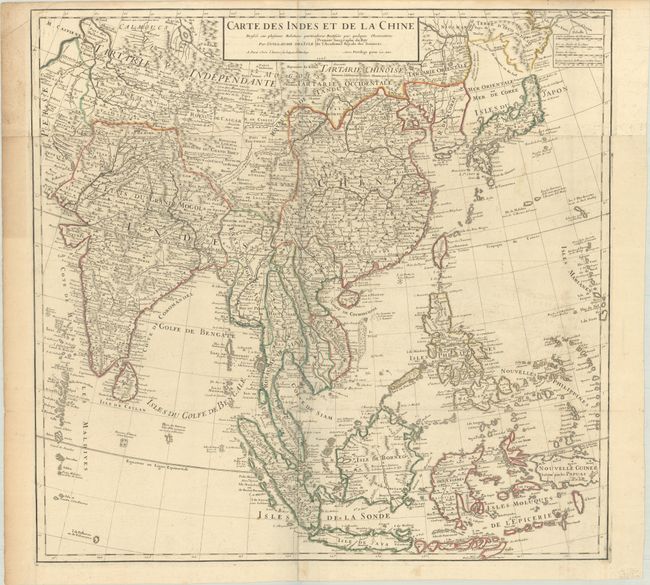
This large, attractive map covers the vast region extensively explored by the Europeans with particular emphasis on the trade routes on the mainland and the islands of the Philippines and the East Indies. In Japan, Hokkaido (Terre d' Yeco ou d'Eso) is attached to the Asian mainland, and the Sea of Japan is named Mer Orientale ou Mer de Coree. Korea is correctly shown as a peninsula, although much too wide. The mythical Lac de Chaamay appears in present-day Burma with several rivers flowing south. The map is filled with details of towns, roads, rivers and topography. Two sheets, joined, as issued.
References:
Condition: B+
Contemporary outline color on a bright sheet with the watermark of a Maltese cross encircled in rosary beads. There is light offsetting, minor soiling in the map, and moderate soiling in the left blank margin.