Subject: Western Hemisphere - America
Period: 1720 (circa)
Publication: Atlas Historique…
Color: Black & White
Size:
17.5 x 13.3 inches
44.5 x 33.8 cm
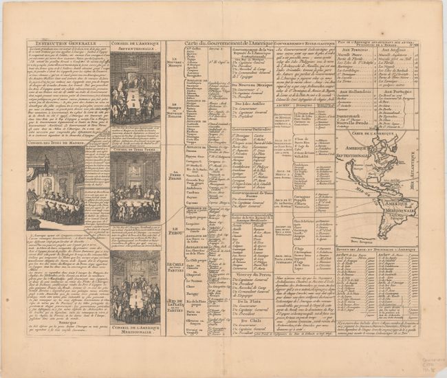
A folio sheet filled with fascinating French text, statistics and four engravings showing the Council of the Indies dividing up Spanish Empire in America. The map itself (3.7 x 5.2") shows an unnamed island of California on the Sanson model. The only political detail is the division of the regions between the colonial powers. Far to the south, a purely speculative Antarctic continent is suggested as Terre Inconnue. Accompanied by 8 pages of related text entitled Dissertation Generale Sur L'Amerique.
References: McLaughlin #164.
Condition: B+
On watermarked paper with light toning. Short centerfold separations confined to the top and bottom blank margins have been closed on verso with archival tape.